


The VMAX E-SCOOTER is available for all current iOS and Android smartphones. You can easilydownloadit fromthe App Store orGoogle Play.
The VMAX E-SCOOTER is compatible with all VMAX models equipped with a TFT display. VMAX models with an LED segment display are compatible with the VMAX CONNECT app instead.
Facility
Maps
Depending on your needs, you can download map data for your region or your next vacation directly in the app. During the initial setup, you'll be asked to select the region you want. 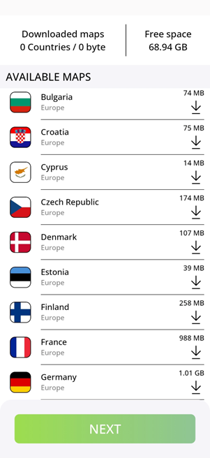
Permissions
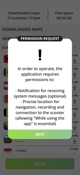
Bluetooth: Toconnect to your scooter, the app needs permission to access your smartphone's Bluetooth module
Location:The app needs access to your exact location fornavigation
Personalization
The app can be customized to suit your personal needs. You can choose between the metric and imperial systems of measurement.
To calculate a realistic range, you'll need to provide some personal information. For this, we need
- Your gender
- Your Weight
- Your height
- Your date of birth.
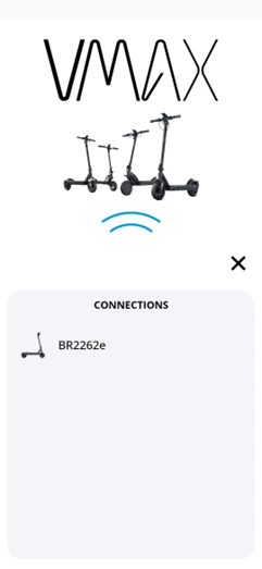
Connect Scooters
When you pair your scooter with your phone for the first time, the app will detect the scooter's Bluetooth module.
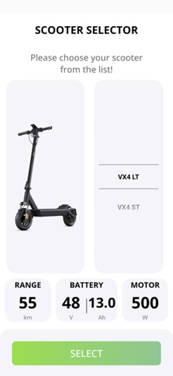
In the next step, you can select your model. Please make sure to select the correct model here; otherwise, the range will not be displayed or calculated correctly.
Navigation
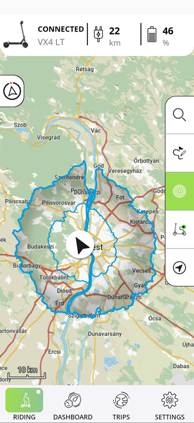
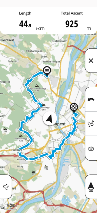
In the app's main menu, you'll see your current location as well as a lot of relevant information about your scooter's current status, such as its range and battery level.
You'll also see the range displayed on the map; this takes into account not only your personal data but also elevation information and road conditions.
In your app's main menu, you can search for any address or POI and start navigation right away. Alternatively, you can select a location directly on the map.
If automatic route recording is turned off, you can start it manually in the navigation area.
Settings
You can adjust various settings to customize the navigation experience to your needs:
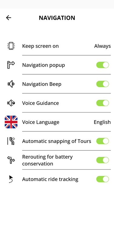
- You can leave your screen on for the entire navigation session or just for the dashboard so you can access the information at any time. If you're using turn-by-turn navigation on your scooter's display, you can also set it to turn off automatically after a certain amount of time to save battery life.
- Navigation display: If needed, you can display pop-ups that show the upcoming directions
- To make sure you don't miss any instructions, your smartphone can alert you to upcoming instructions with a beep
- If necessary, the app can also read all the instructions aloud
- You can select a different language for the voice prompts than the display language
- When you import a GPX track, you can either navigate directly along the track. Alternatively, the app can overlay the track onto the stored road network.
- If the remaining range drops unexpectedly quickly during the trip, the app can automatically recalculate the route if desired
- You can choose whether you want to record all rides or only certain ones
Draw and Plan
If you don't want to find the fastest route to your destination but have a specific route in mind, you can map it out using the "Draw and Plan" feature on your phone.
 The app then searches for rideable routes on your tour.
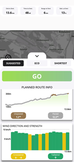
Before you start your tour, you can view all the information about it to help you find the best tour for you
Dashboard
You'll also find a fully customizable dashboard in your app.
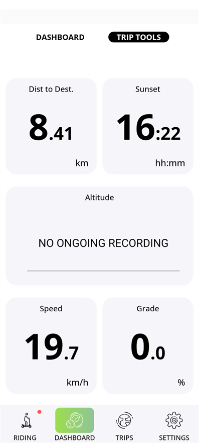 Here you can view a variety of information about your current trip and your scooter:
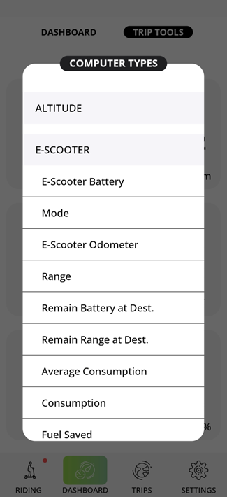
History
In the app's history, you'll find your recorded trips as well as your imported tours.
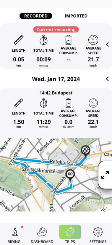
After selecting a tour, you can choose whether you want to drive to the start of the tour or to the nearest point along the route.
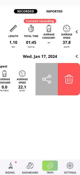
You can easily share your recorded tracks through the app. You can also easily import routes as GPX tracks from your phone's internal storage.